Living Lab Dataset
AI-powered ultra-high-resolution drone imaging for precision crop protection through weed, disease, and pest detection
AI Models; Drones; Machin...
Agrifood Technology
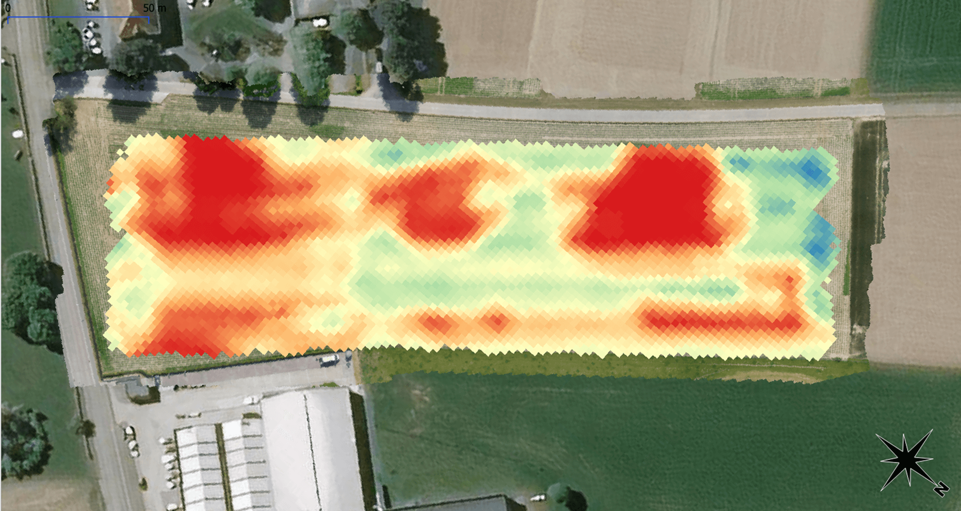
The living lab uses ultra-high resolution RGB images on drones and AI for the detection of weeds, diseases and pests in arable crops. A specific data processing pipeline is used to reduce the labor intensive annotation tasks associated with deep learning for anomaly detection. Task maps will be created resulting from this detection pipeline to perform site-specific spraying.
Digital Components
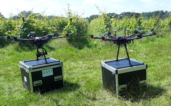
- Hardware: DJI M600
- DJI M350
- Rasperry pi 5b and pico
- Septentrio GPS/GNSS receiver
- 2 RTK antennas
- Netgear nighthawk M2 router
- Software: QGIS
- The data processing software
- Sensors: Sony Alpha 7 III
Type
- UAV
- data processing pipeline
Living Lab Country
- Belgium
Application Scenarios
- Pest management & spraying efficiency
Agricultural Sector
- Arable crops
Required Skill Level
- High
Target users
- Farmers
- Contractors
- Drone pilots
- Advisors
Country of Origin
- The drones (DJI) - China; The raspberry pi and pico - United Kingdom; The GPS receiver - Belgium; The Netgear router - United States; The software and AI models - Belgium; The camera (Sony) - Japan.