Living Lab Dataset
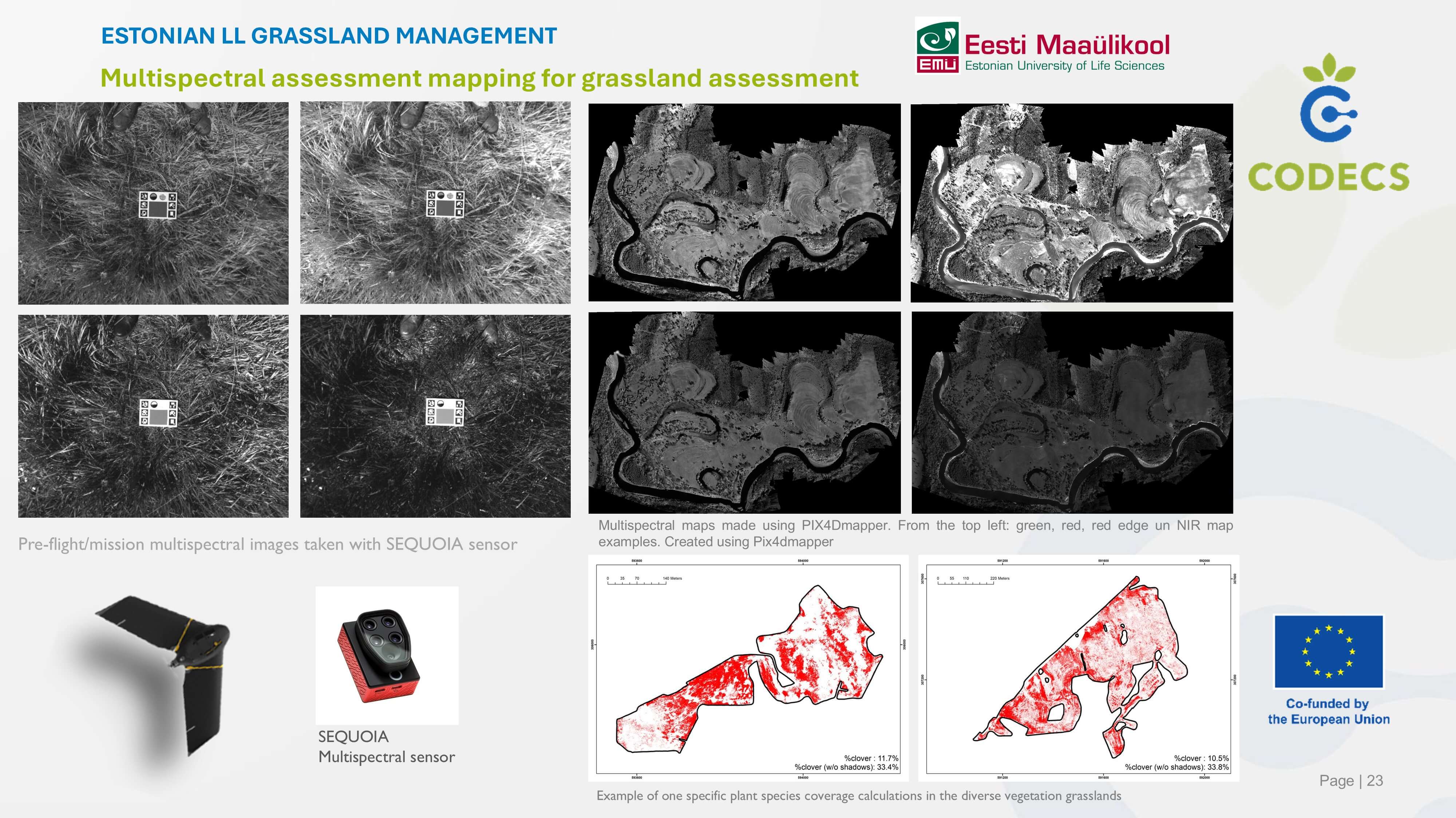
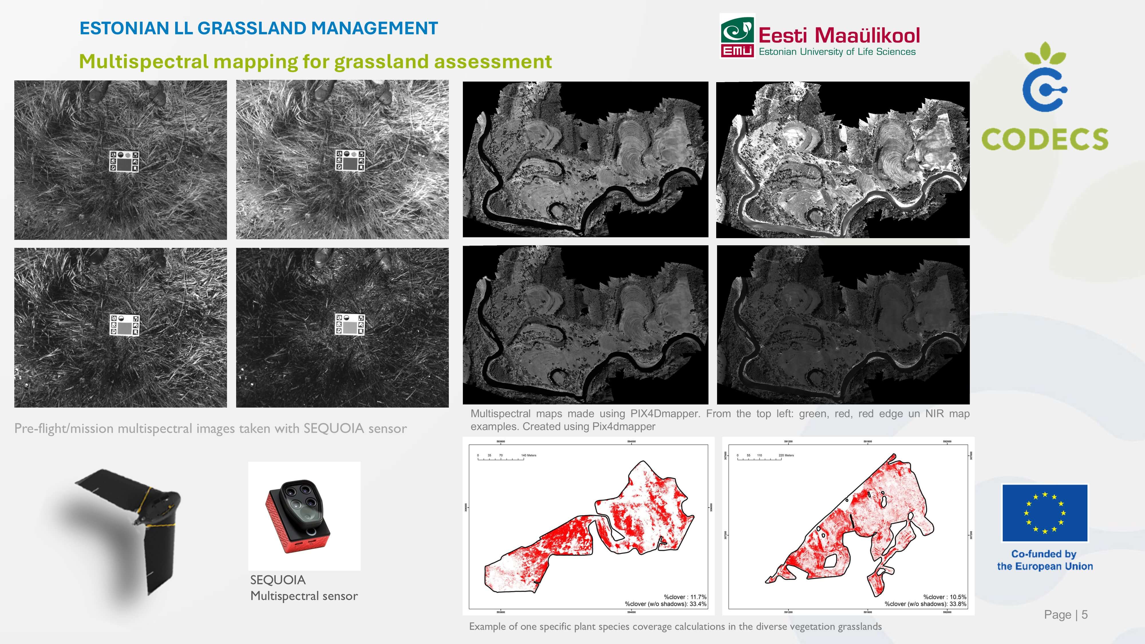
Multispectral mapping for grassland assessmentE
Maintenance of Grasslands...
stonian Grassland management
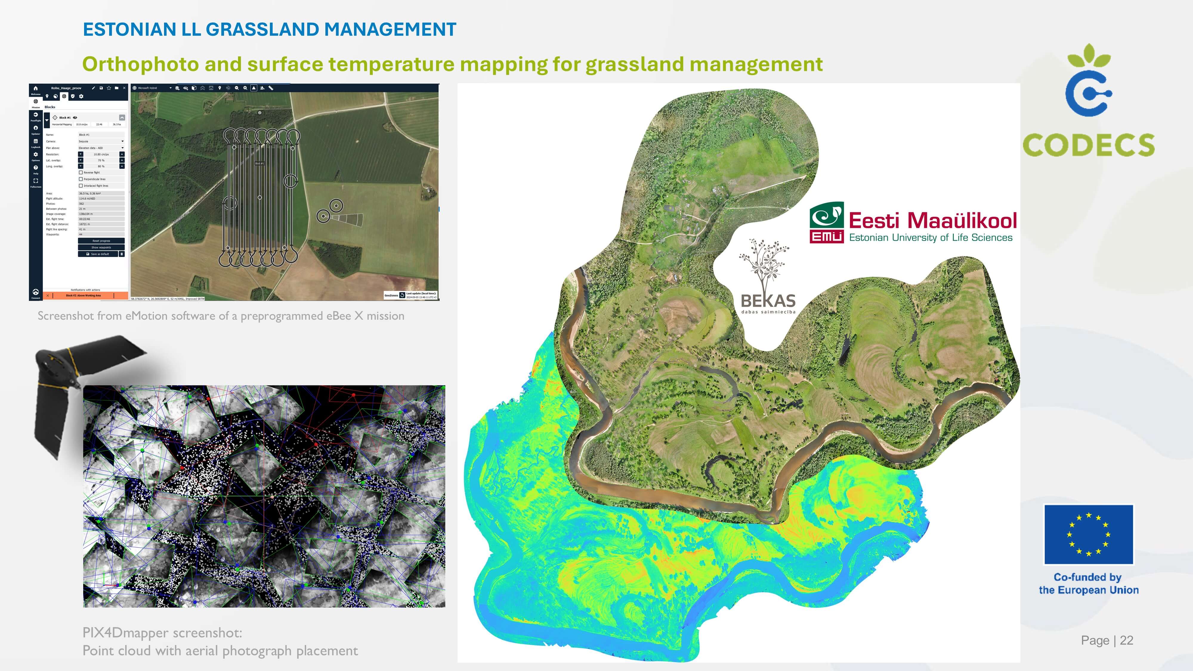
The EbeeX fixed-wing drone is equipped with a multispectral sensor operated by a professional remote sensing team/pilot to create high-resolution multispectral maps/data sets of grasslands managed by livestock farmers. Data is further analysed by the remote sensing team to create individual vegetation species models and then automate the plant species coverage calculations. Applied to plan and assess semi-natural grassland management and restoration
Digital Components
- eBeex drone
- Parrot Sequoia multispectral sensor
- Pix4Dmapper
- QGIS
- R
Type
- UAV with interchangeable sensors
- photogrammetry software
Living Lab Country
- Estonia
Application Scenarios
- Livestock
- Biodiversity
- Vocational training & advisory services
- Water management
Agricultural Sector
- Animal husbandry
Required Skill Level
- High
Target users
- Livestock farmers
- Environmental researchers
- Grassland specialists
- Advisors
Country of Origin
- Not known