Living Lab Dataset
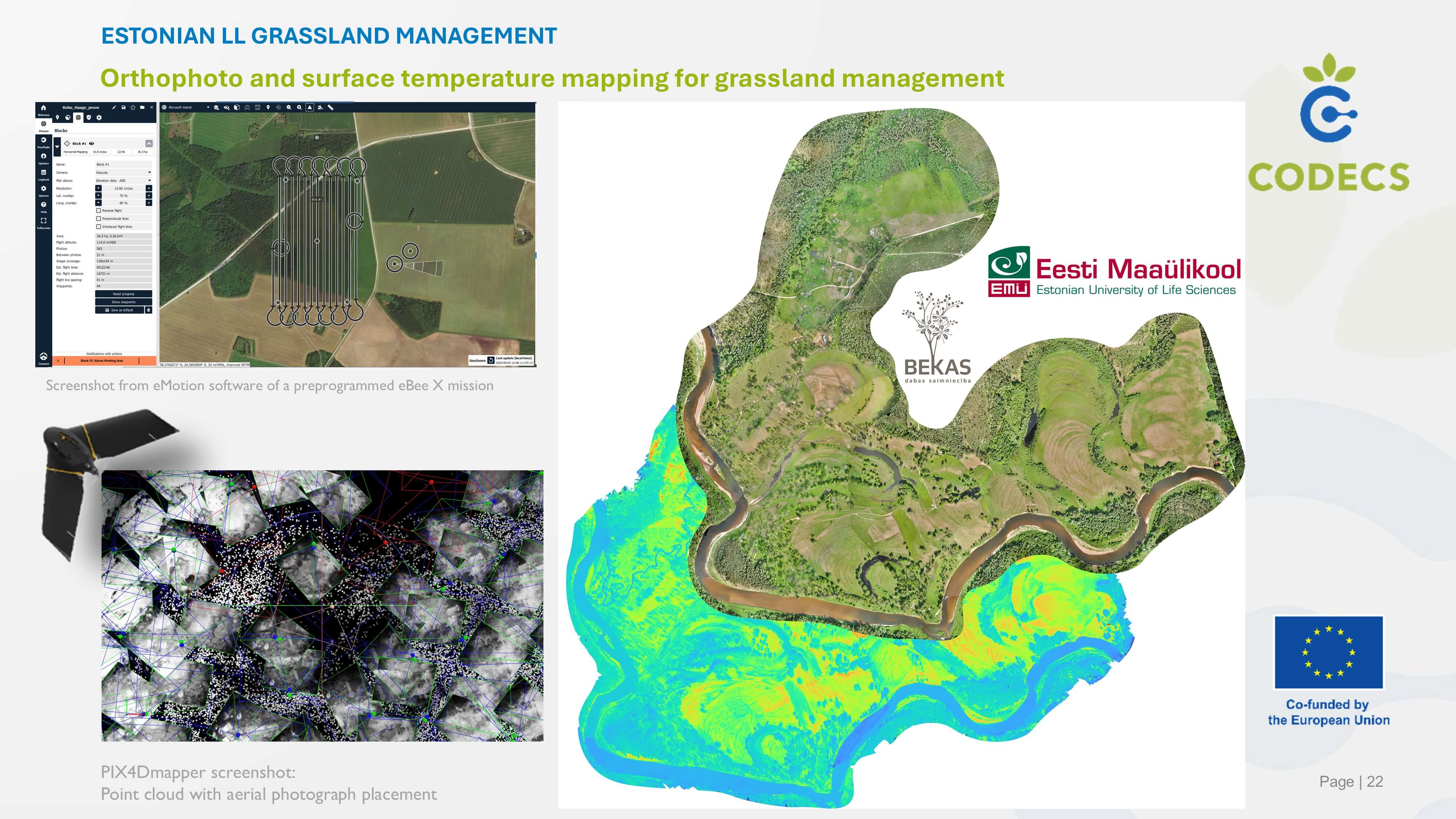
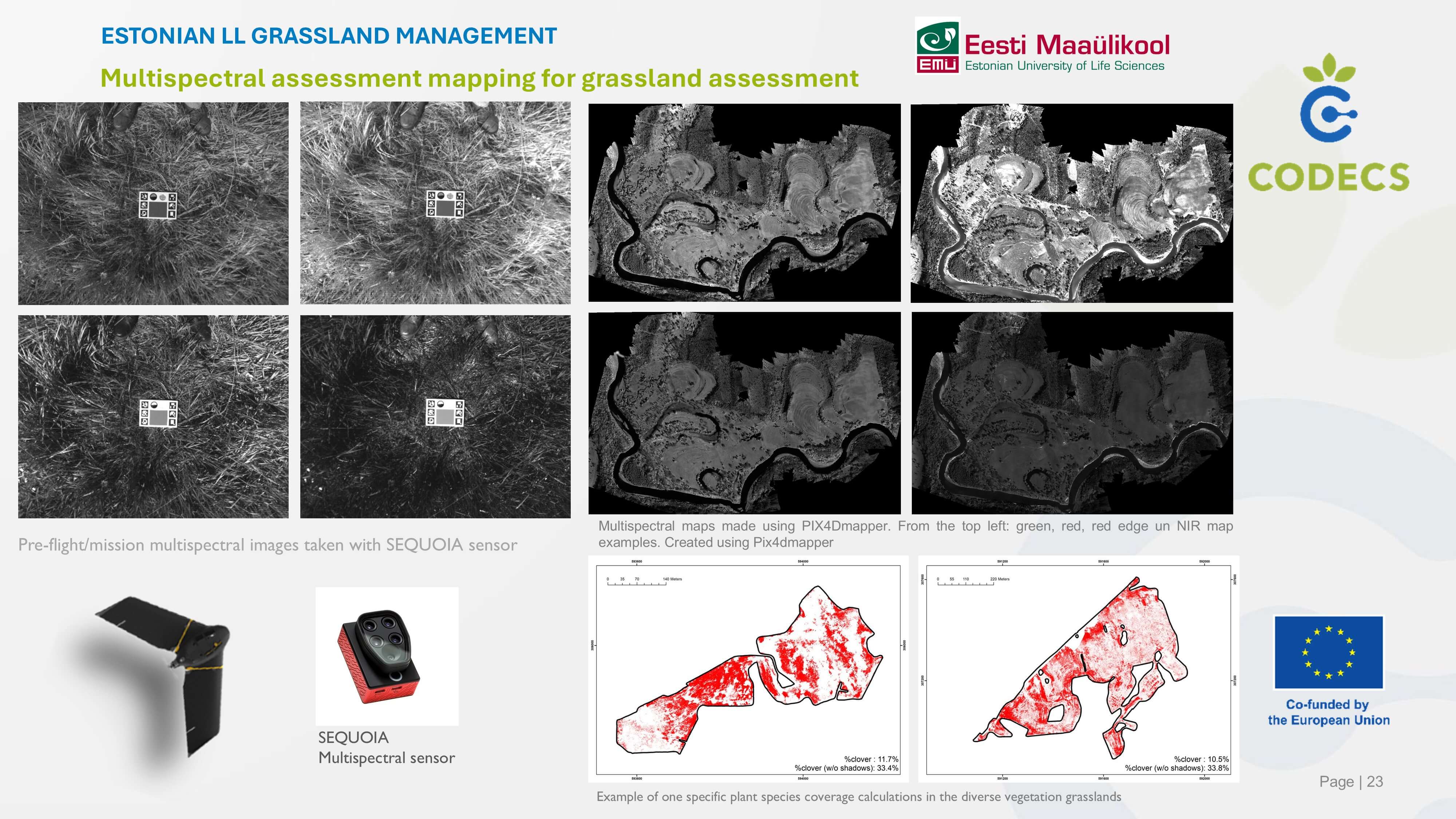
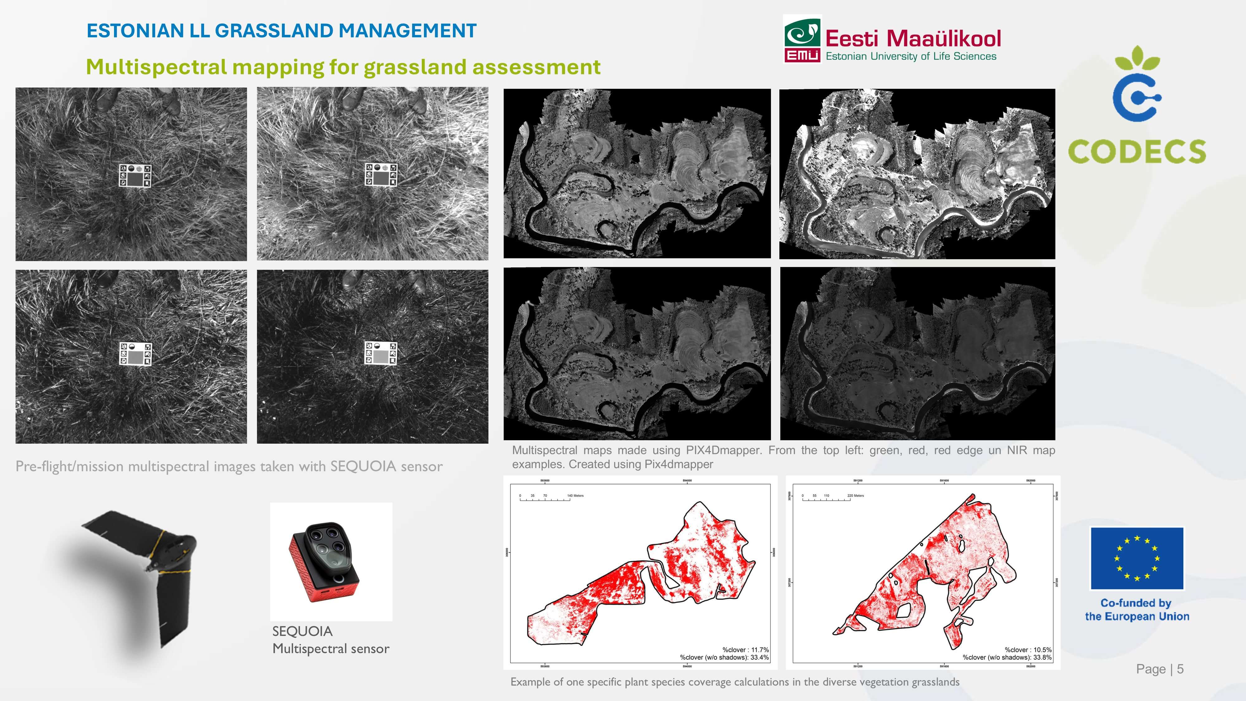
Orthophoto and surface temperature mapping for grassland management
Animal Welfare; Animal He...
Estonian Grassland Management
The EbeeX fixed-wing drone is equipped with a dual RGB/thermal mapping camera rig operated by a professional remote sensing team/pilot to create high-resolution orthophoto and surface temperature maps of grasslands managed by livestock farmers. Farmers use such digital maps to plan grassland management and as communication materials; maps are also passed on to researchers and grassland specialists for further habitat assessment.
Digital Components
- eBeeX drone
- eMotion
- Duet T sensor
- Pix4dmapper
- QGIS
Type
- UAV with interchangeable sensors
- photogrammetry software
Living Lab Country
- Estonia
Application Scenarios
- Livestock
- Biodiversity
- Water management
- Vocational training & advisory services
Agricultural Sector
- Animal husbandry
Required Skill Level
- Medium
Target users
- Livestock farmers
- Environmental researchers
- Grassland specialists
- Advisors
Country of Origin
- Not known