Vocational training & advisory services
A flexible unmanned aerial vehicle for precision agriculture
Source: smartAKIS
Last update: 05-03-24
An unmanned aerial vehicle (“VIPtero”) was assembled and tested with the aim of developing a flexible and powerful tool for site-specific vineyard management. The system comprised a six-rotor aerial platform capable of flying autonomously to a predetermine...
Advisory platform for small farms based on earth observation
Source: smartAKIS
Last update: 05-03-24
Earth Observation (EO) refers the collection of information about our planet, using remote sensing technologies such as sensors mounted on satellites or drones. The European Union’s Copernicus programme provides EO data freely and openly for use by policy-...
Agrenio
Source: smartAKIS
Last update: 05-03-24
Mobile app that offers to farmers Precision Agriculture (PA) benefits in an easy and cheap way. “AGRENIO” is an easy-to-use software solution to support the efficient and rational irrigation and fertilization for the farmers. The innovative aspect of the a...
AgriSENSact
Source: smartAKIS
Last update: 05-03-24
An integrated Precision Agriculture (PA) system for the precise management of crops integrating several of the main practices of PA. The AgriProbe concept is a modular device featuring specific modules for sensors, energy supply and communications, tailore...
Algebraic path tracking
Source: smartAKIS
Last update: 05-03-24
Service units used in precision agriculture are able to improve processes such as harvesting, sowing, agrochemical application, and manure spreading. This two-part work presents, a path tracking controller based on an algebraic approach for an articulated ...
App - Agrio Technology to help you grow the future
Source: IPMworks
Last update: 20-09-24
Agrio is an artificial intelligence-based precision agriculture solution that helps you to remotely monitor, identify, and treat plant diseases and pests in your field, farm, and garden. The app leverages and deploys proprietary artificial intelligence and computer vision algorithms. The algorithms contain the knowledge of numerous agronomists and agriculture experts and continuously improve. Available in a number of languages.
Atlas
Source: smartAKIS
Last update: 05-03-24
MicaSense Atlas: Intelligent analytics to harness the power of smart sensors. Atlas is a simple to use cloud based platform built to provide intelligent solutions for precision agriculture. After processing raw data with Pix4Dag or Pix4dmapper Pro, turn...
BEECAM ecosystem
Source: smartAKIS
Last update: 05-03-24
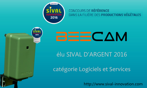
BEECAM ecosystem allows performing analysis in the area of biodiversity, agronomy and precision agriculture. BEECAM is associated with analysis software, including the AGATHE software to recognize the insect population density in a given area (field, green...
COPERNICUS
Source: DESIRA
Last update: 01-09-23
a global, continuous, autonomous, high quality, wide range Earth observation capacity
Cotton yield estimation using very high-resolution digital images acquired with a low-cost small unmanned aerial vehicle
Source: smartAKIS
Last update: 05-03-24
Yield estimation is a critical task in crop management. Traditional methods are costly, time-consuming, and difficult to expand to a relatively large field. Remote sensing can provide quick coverage over a field at any scale. Satellite remote sensing is us...
Development and performance experiment on grain yield monitoring system of combine harvester based on photoelectric diffuse reflectance
Source: smartAKIS
Last update: 05-03-24
Development of remote sensing (RS), geographical information system (GIS) and global positioning system (GPS) has provided new methods for obtaining field grain yield information, which allows better description of spatial variability for grain yield. Moni...
E-Agri
Source: smartAKIS
Last update: 05-03-24
The European research institutions including VITO, Alterra, JRC and University of Milan, have developed series of agricultural monitoring approaches to support European Common Agriculture Policy (CAP). These approaches are based on the European Information...
EOFARM
Source: smartAKIS
Last update: 05-03-24
EOFARM project cover the topic of Precision Farming (PF), one of the main applications of Earth Observation in the agriculture industry; it makes use of satellite images to help farmers in monitoring and managing crops from planting to harvesting.
EOS Crop Monitoring
Source: IPMworks
Last update: 20-09-24
EOS Crop Monitoring is an online satellite-based precision agriculture platform for near-real-time field monitoring created by EOS Data Analytics (EOSDA). The platform is a one-stop solution that integrates multiple types of data (crop health, weather conditions, crop rotation, field activities, elevation, soil moisture, and a host of other types) all in one place. Near-real time field monitoring ensures timely detection of crop health issues, including heat/cold/water stress, diseases, pests, weeds, and more. Early-stage detection of these anomalies speeds up the decision-making process, allowing growers to save time, reduce costs, and increase yields.
Environmental parameters monitoring using wireless sensor networks
Source: smartAKIS
Last update: 05-03-24
Development of a WSN application for precision agriculture, which is deployed in a pepper vegetable greenhouse. In particular, the paper presents the experimental setup and the preliminary results of the part of the application used for data measuremen...
FFARM Farming From Aerial Remote Mapping
Source: smartAKIS
Last update: 05-03-24
Drones are a part of new precision agriculture revolution. Many farming tasks could be worked by Drones by precision navigate in work mission plan and perform actions at set locations, for example, gathering crop data, spraying a pesticide, planting Monit...
Farm Tools
Source: smartAKIS
Last update: 05-03-24
FarmTools is a web solution for decision and operation support, that can be securily used from everywhere, and has its design and use based on a geographic approach to the farm everyday operation and management procedures. Its functionality has a season e...
Farm manager
Source: FAIRshare
Last update: 01-02-26
Farm manager - farm business planning/modelling and decision-making for agricultural advisors, farmers and education
Farmsat Mapping Application
Source: smartAKIS
Last update: 05-03-24
Farmsat™ Mapping Application is an easy-to-use, customizable precision agriculture tool based on historical data and in-season satellite imagery. You can use its powerful, intuitive interface to assess field’s variability and quickly create variable-rate ...


